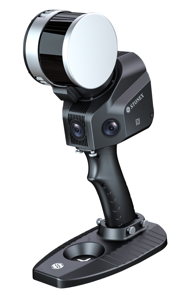
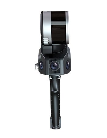
X120Go SLAM Laser Scanner
FEATURES
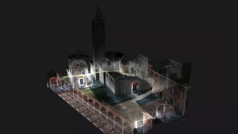
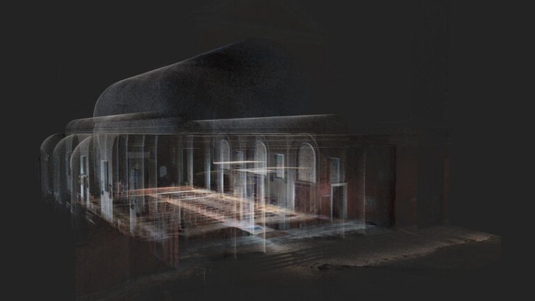
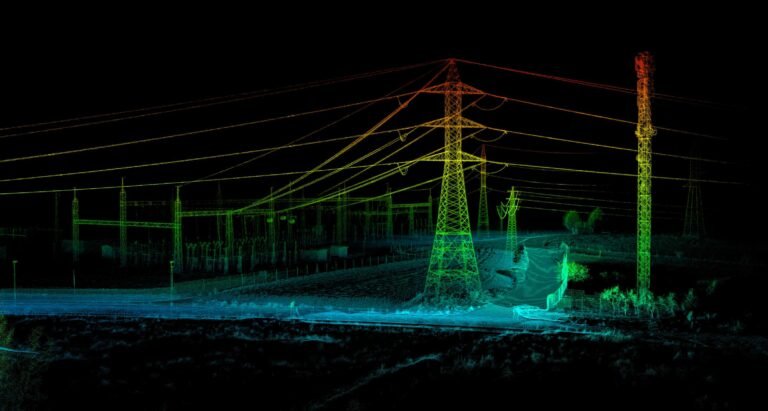
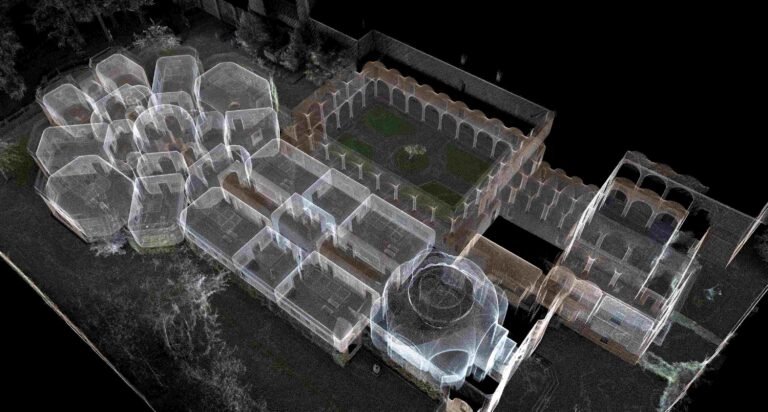
RAPIDITY AND REDUCED WORKLOAD
No more multiple scan station, just move around the scene to collect the entire 3D point cloud, without time-consuming cloud to cloud alignment. Download the full data right after the capture.
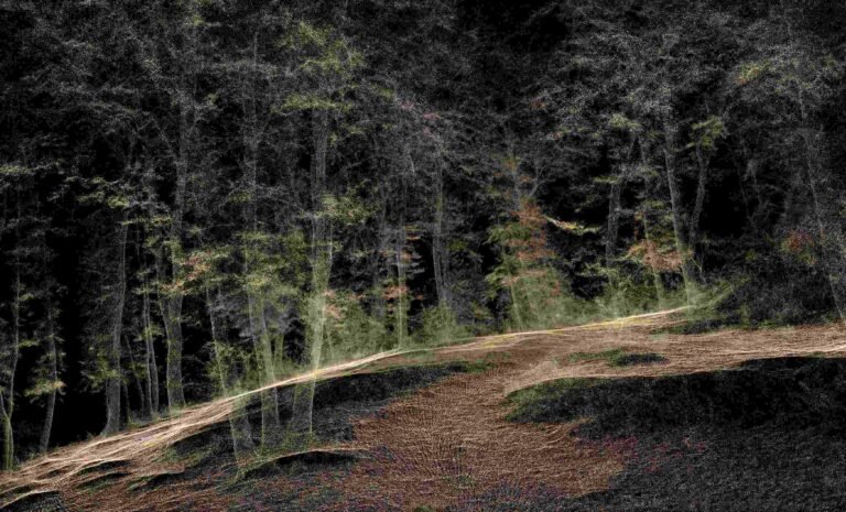
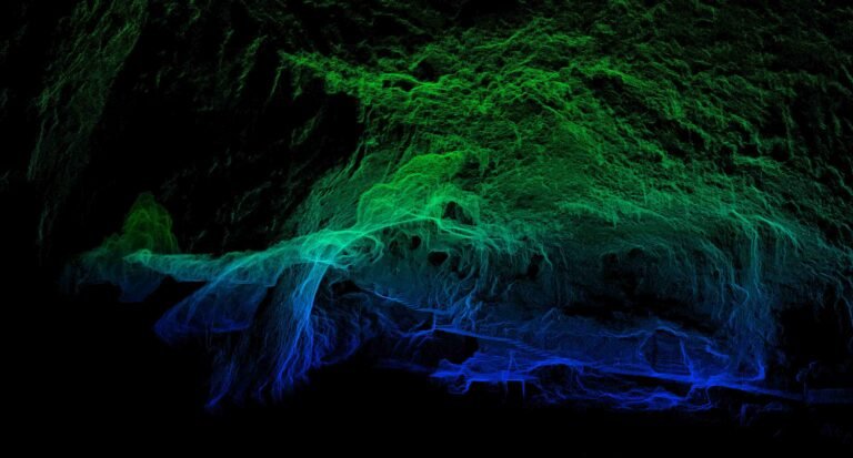
FLEXIBILITY
Combine indoor & outdoor data, even in the most demanding environments.
REAL TIME PREVIEW
See your scanning progress in real time using the dedicated App.
AUTOMATIC CONTROL POINT MEASUREMENT
When capturing data, X120GO is able to collect reference points too. They can be matched with known control points to georeference the scans.
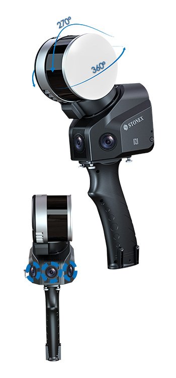
INTEGRATED CAMERAS
Three integrated 5MP cameras are able to cover the wide field of view of the scanner, obtaining coloured point cloud and helf-panoramic images.
X-WHIZZ MODE
X120GO merges mobile and stationary surveying. To the advantageous SLAM solution that allows you to survey large areas in a very short time, it combines a stationary mode to scan with higher resolution. It is the perfect trade-off for those who need speed and detail in a mobile survey.
Devices
- S880 GNSS Receiver
- S850 GNSS Receiver
- S900 Plus GNSS Receiver
- S580 Plus GNSS Receiver
- S80G RTK GNSS
- S55G Controller RTK GNSS
- S55 Controller
- UT12P Rugged Tablet
- S80 Rugged Tablet
- SR35 External Radio
- R60 Android Total Station
- R20 Total Station
- A30 Automatic Level
- X120Go SLAM Laser Scanner
- XVS VSLAM Scanner
- SC2200 GNSS Receiver
- SA1500 GNSS Antenna
- SA85 GNSS Antenna
- Cube a Software
- Cube Connector Software
- Cube-Manager Software
Sponsor
