Our integrated solutions support both indoor and outdoor mapping applications, enabling rapid, precise, and scalable data acquisition for projects of all sizes.
MapCom provides advanced LiDAR data processing, 3D laser scanning, photogrammetry, and digital modeling services that support engineering, construction, urban planning, mining, environmental monitoring, and infrastructure development projects across Iraq and the region.
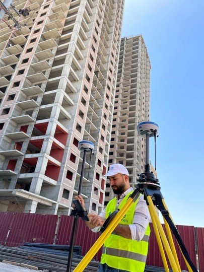
By combining cutting-edge LiDAR technologies, SLAM-based scanning systems, GNSS RTK positioning, and intelligent geospatial workflows, we deliver highly accurate 3D spatial data that helps organizations visualize, analyze, and manage complex environments with confidence.
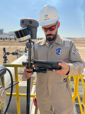
MapCom offers professional close-range photogrammetry services using the advanced Stonex XVS vSLAM 3D Scanner as part of our high-precision spatial data capture solutions.
This portable handheld system combines dual cameras, visual SLAM, and IMU sensors to generate highly detailed 3D models and point clouds with minimal setup and rapid field deployment.
3D laser scanning is one of the most powerful technologies available for capturing detailed spatial information of terrain, structures, and complex environments with exceptional speed and precision.
MapCom utilizes advanced handheld SLAM-based laser scanning systems that integrate:
This integrated workflow allows precise 3D mapping in both GNSS-accessible and GNSS-limited environments.
Our laser scanning systems combine intelligent positioning and real-time processing technologies for maximum accuracy and operational efficiency.
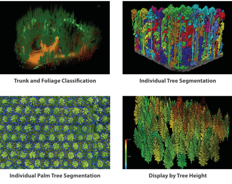
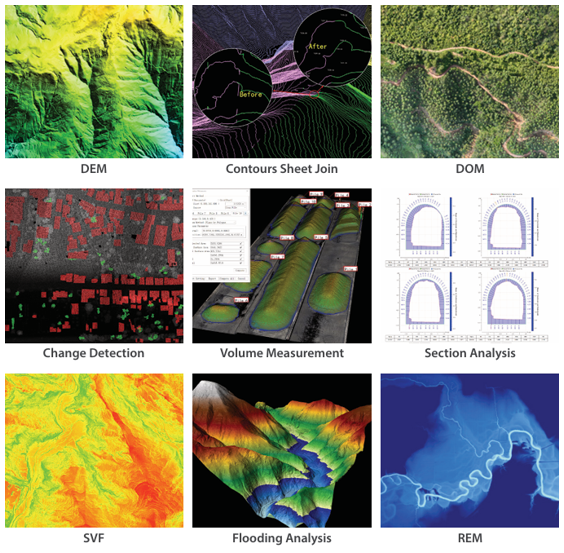
Our LiDAR and 3D modeling services support a broad range of geospatial and engineering applications.
MapCom delivers intelligent terrain analysis and automated surface modeling solutions using advanced LiDAR processing workflows.
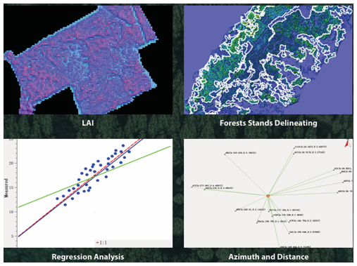
Our advanced spectral and multi-source analysis workflows enable intelligent environmental and urban data interpretation.
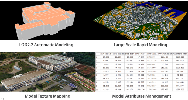
MapCom develops realistic digital twin environments and intelligent 3D city models using advanced LiDAR and spatial data processing technologies.
We utilize LiDAR, SLAM, GNSS RTK, UAV systems, and AI-powered processing workflows to deliver high-accuracy spatial intelligence.
Our workflows support infrastructure, construction, mining, environmental, and government projects requiring precise and reliable geospatial data.
Modern scanning technologies allow rapid field deployment and efficient project delivery with minimal operational downtime.
All outputs are optimized for CAD, GIS, BIM, and digital engineering platforms.